

![]()
The Malta Census Web-mapping Website
This website presents the results of a research into Web-mapping technologies, mainly Imagemapping and GIS-Client systems. The research was carried out as part of an MSc in Geographical Information Systems (GIS) at the University of Hudderfield (United Kingdom), through the UNIGIS programme which is organised in conjunction with the Manchester Metropolitan University and the University of Salford.
The data for this study was made available for use by the Malta Planning Authority.
The owners of the Census data remain the Malta Central Office of Statistics
The data is also available in CD format and can be accessed directly from the CD using Internet Explorer 5 or Netscape 6. The main CD (MaltaCens) contains the full ImageMap and PopPyr sections and the zipped files links. The other 4 CDs (CensArc) contain the complete Census GIS-Client for ArcExplorer (ESRI).
Further data and maps shall be included in due course. Reviewers who wish to use specific maps included, please send an email to: sformosa@europe.com. If reviewers or researchers are interested to include their work in this site send requests to:
Saviour Formosa
39, Arca
Triq is-Sibbien Marsascala ZBR 10
Malta
The Website Data and Map Sections
i) ImageMap - An Imagemapping system of the Malta Census
ii) CensArc - A GIS-Client system making available the complete datasets used in this study
iii) PopPyr - An interactive Population Pyramid Imagemapping system covering the 1957-1995 Censuses
Introduction to MSc Research Study
Abstract
In a society where data creation is expanding exponentially and distribution is spread over an entire planet, the search for tools to improve accessibility and dissemination of data grows more acute. User-friendliness and instant access to reliable data has rapidly become the main issue of concern for researchers and organisations worldwide. This study investigates the use of Web-mapping technology and its impact on Geographical Information Systems (GIS).
The study also investigates the diffusion of GIS to the general public through the use of common web browsers or freeware. It researches the feasibility of Web-mapping as a solution to the current lack of accessible data in the Maltese Islands. The study uses the 1995 Population and Housing Census data in the Maltese Islands as a test case to demonstrate the feasibility of the Web-mapping technologies.
The project entailed the carrying out of three surveys: first the current Web-mapping situation, second a pre-review questionnaire and third a post-application analysis questionnaire. The purpose of the surveys was mainly to elicit the reviewers opinions on data accessibility and to propose further systems developments. The study was accomplished through an analysis of current websites having Web-mapping functions, mainly the type of technology employed and the level of interactivity with spatial data through on-line maps. Based on the findings, a full-scale dual system Census project was developed giving an opportunity to both GIS professionals and the general public the faculty to access an extensive amount of data either through Imagemaps (interactive on-line maps) or through a GIS-Client system that users can analyse, query and map their requests using a freeware GIS-viewer.
Reviewer feedback based on the two developments resulted in the identification of a need to implement the technologies as part of data management and presentation as well as to further develop Web-mapping systems in such areas as environment, transport, planning and the research field. The results indicate a willingness to readily accept on-line GIS as the medium for data distribution, querying and analysis through its integration with current systems both within the organisation under study and in external entities.
An Extended Outline covers the topic literature review and the original project proposal. The whole text will be made available in this site.
![]()
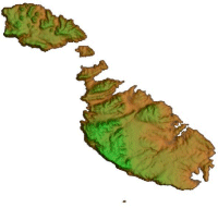
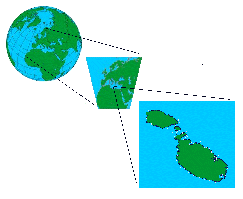
The Maltese islands comprise an archipelago of 14 islands situtaed in the middle of the Meditteranean sea. The 2 main islands were inhabited by 378,132 persons as of Census 1995, which population has increased to 399,000 to date. The main island, Malta houses around 350,000 persons whilst Gozo is home to 30,000 persons. The only other inhabited island, Comino is home to 1 family.
The Maltese Archipelago is the 2nd most dense country in the world with over 1,200 persons per square kilometer.
The islands have a total area of 316 square kilometers.
For historic, socio-cultural and generic information the islands visit the following sites:
![]()
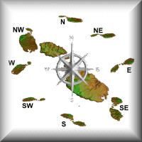
The Compass Route
The following maps were generated using MapInfo and Vertical Mapper. Source data is copyrighted by the Malta Planning Authority.
![]()
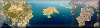
The photos in this section were provided by the Local Plans Unit and the Environmental Management Unit of the Malta Planning Authority who hold their copyright.
![]()
Home, MSc Project, Imagemapping Section, Census ArcExplorer Section, Population Pyramids, Links
Saviour Formosa Email: sformosa@europe.com