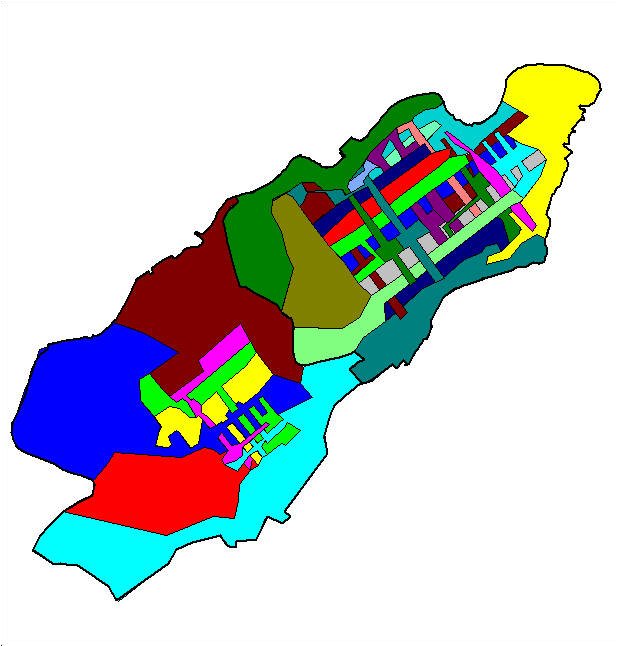
This imagemap example of the Valetta and Floriana Local Councils depicts the extent of a full EAS linkmap. The whole area of the councils are covered by enumeration area boundaries, which is a visual improvement over the Maltese Islands EAS Map. The linked datatables can contain a number of attributes linked through an onclick function which attivates a new data browser window.
![]()
The 2 EAS maps were generated using web.Publisher.
![]()